Marine Mammal Protected Area Task Force website
The IMMA Secretariat has continued to work on improving the Marine Mammal Protected Area Task Force website and IMMA eAtlas. If you haven't explored the site lately, we encourage you to do so, and test the new features that allow searching and filtering by specific IMMA name as well as region or category. The IMMA searchable database also allows users to search and filter by species and location/EEZ. The secretariat is now in the process of developing downloadable factsheets for each of the IMMAs in the Western Indian Ocean and Arabian Seas region. There are already a few regional factsheets available – see examples here for the Mascarene Plateau, Watamu, and Pemba Channel. The intention is to have a glossy and attractive way of providing the IMMA portfolio text that can be downloaded and shared with decision makers etc.
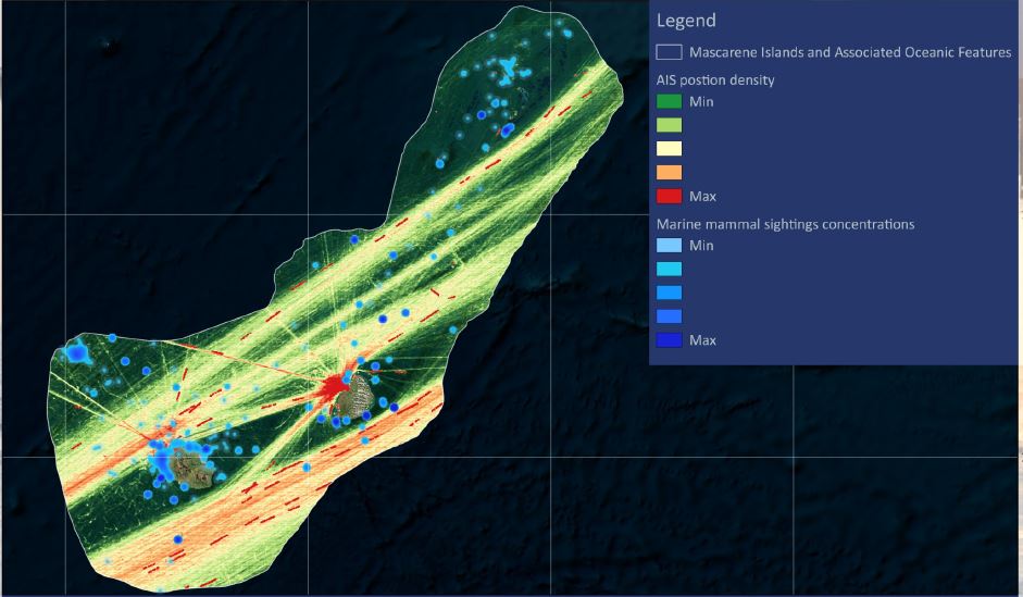
The website also features a new report that is the result of collaboration between WWF, the IUCN MMPATF, the International Whaling Commission (IWC) and Oceanmind. The report is based on an analysis of vessel traffic in 114 IMMAs around the world. For every IMMA, a table has been generated with statistics of unique vessel IDs transiting the IMMA each month, as well as heat maps and graphs depicting categories of vessel traffic by month. The report also features a ranking of the sites where the overlap between vessel traffic and whale populations indicates possible risk of ship strikes and two case studies examining the patterns of vessel traffic in relation to cetaceans in greater detail. One of the case studies is located in the western Indian Ocean and refers to the IMMA of the Mascarene. This IMMA encompasses the Islands of La Reunion and Mauritius and their surrounding seamounts and was flagged as one of the top 10 risk areas for shipping and fishing impacts. The case study includes a more detailed analysis of the overlap of vessel tracks and marine mammals, based on humpback whale tagging data and cetacean distribution data collected by Globice and the Observatoire Pelagis aerial surveys (REMMOA). The report discusses the potential risk posed to cetaceans, as well as the data gaps that need to be addressed in order to undertake a more robust risk analysis.
Links for direct downloads of the report and case studies can be found here.
Please consider using these valuable new resources for management and conservation efforts in your region, and sharing them with your wider networks and contacts.
Contributors: Gianna Minton, Gill Braulik, Violaine Dulau